Mapping Australian history and culture
We acknowledge the Traditional Owners of country and pay our respects to Elders past, present and emerging. First Australians...
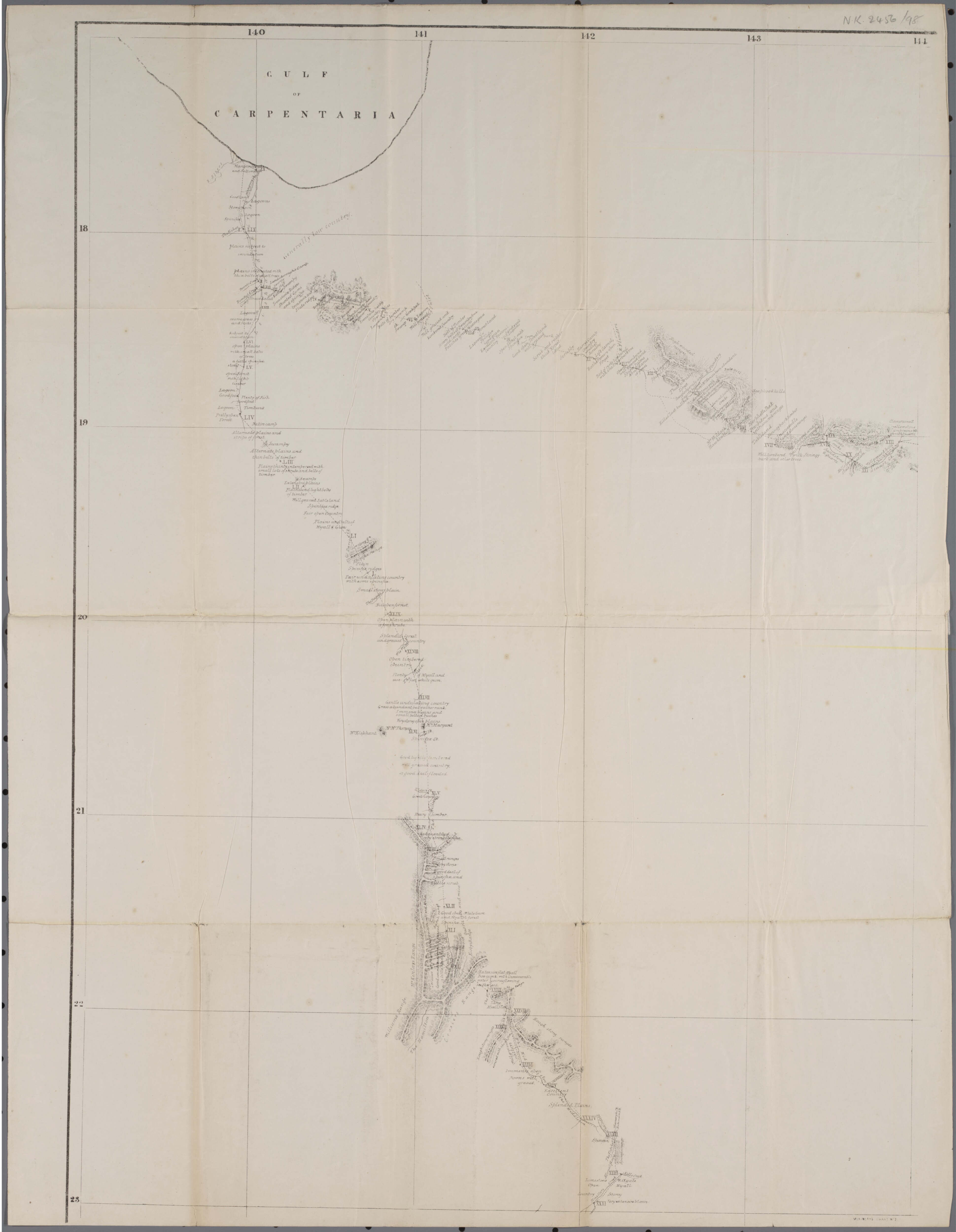
| Name | 1862 McKinlay expedition in Carpentaria |
|---|---|
| Description | This map shows the 1862 journey of the McKinlay expedition while in the region that is now Carpentaria Shire. |
| Type | Journey |
| Subject | |
| Linkback | |
| Image |
|
| Content Warning | This map uses information from the European account of this expedition and does not draw on local knowledge. All locations are approximate. |
| Number of places | 17 |
| Contributor | Claire Brennan |
|---|---|
| Creator | Claire Brennan |
| Publisher | Northern History Services |
| Contact | |
| DOI | |
| Source URL | |
| License | CC By-NC |
| Allow ANPS? | No |
| Citation | |
| Usage Rights |
| Language | |
|---|---|
| Latitude From | |
| Longitude From | |
| Latitude To | |
| Longitude To | |
| Date From | |
| Date To | |
| Date Created (externally) | 2025-08-13 |
| Added | 2025-08-13 22:43:38 |
| Updated | 2025-09-02 16:53:48 |
Camp 9

